


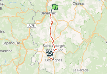
la canourgue les vignes

RoMo
User

Length
25 km

Max alt
942 m

Uphill gradient
825 m
Km-Effort
37 km

Min alt
419 m

Downhill gradient
969 m
Boucle
No
Creation date :
2022-09-07 06:28:38.893
Updated on :
2022-09-12 19:42:04.272
7h37
Difficulty : Difficult

FREE GPS app for hiking
 SityTrail
IGN / Geographical institutes
SityTrail Plus
The world is yours!
About
Trail Walking of 25 km to be discovered at Occitania, Lozère, La Canourgue. This trail is proposed by RoMo.
Description
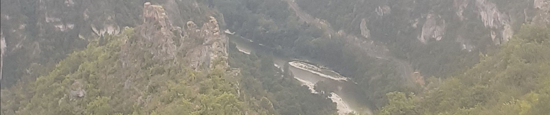
beau point de vue sublime
Photos


Positioning
Country:
France
Region :
Occitania
Department/Province :
Lozère
Municipality :
La Canourgue
Location:
La Canourgue
Start:(Dec)
Start:(UTM)
517098 ; 4919849 (31T) N.
Comments